Our tourist maps
Canada like you’ve never seen it before! Here are 4 brand new tourist maps for your trip to Canada. Explore the wonders of eastern Canada between Quebec City, Montreal and Toronto, or head west, to Vancouver and its exceptional natural surroundings! Explore the Icefields Parkway in the Canadian Rockies and enjoy the fresh air of the many national parks. Don't miss any of the must-see attractions and organize your stay with the travel map. This is everything you need to make your trip to Canada an unforgettable experience.
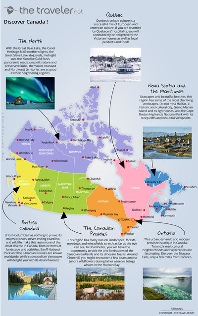
Region map
A trip to Canada goes hand in hand with nature and extraordinary landscapes. The second largest country in the world offers a variety of breathtaking landscapes! The panoramic views of the Rockies are breathtaking while Niagara Falls’ majestic flow is one of the most impressive on earth. Quebec, represented by its two main cities, Montreal and Quebec City, is distinguished by its French-speaking population, but also by a fascinating cultural diversity. On the west coast, you will find Vancouver, a city facing the Pacific and surrounded by the Rocky Mountains. The St. Lawrence River, Ontario and Alberta are also worth a visit; therefore, Canada as a whole is a wonderful country.
Overview of 6 tourist regions
British Columbia
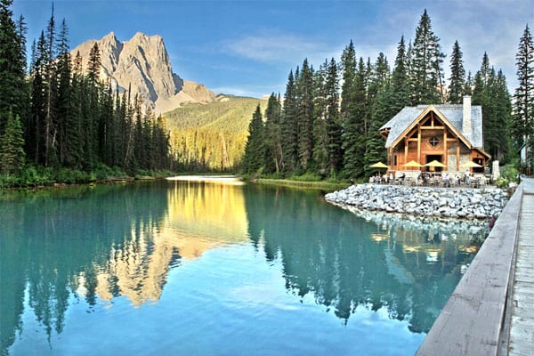
British Columbia has nothing to prove: its majestic peaks, its unending coastline, and its wildlife make this region one of the most diverse parts of Canada, both in terms of landscape and activities. Banff National Park and the Canadian Rockies are known worldwide, while cosmopolitan Vancouver will delight you with its Asian flavours!
Nova Scotia and the Maritimes
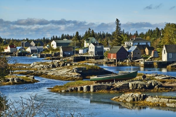
Seascapes and beautiful beaches, this region has some of the most charming landscapes. Do not miss Halifax, a historic and cultural city, Grand Manan Island and its lighthouses, and the Cape Breton Highlands National Park with its steep cliffs and beautiful viewpoints.
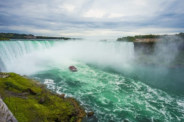
Ontario
This urban, dynamic and modern province is unique in Canada. Toronto’s multicultural neighbourhoods and skyscrapers are fascinating. Discover the Niagara Falls, which are only a few miles from Toronto.
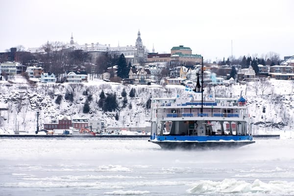
Québec
Quebec’s unique culture is a successful mixture between Europe and America. If you’re charmed. Not only will you be charmed by the Quebecers’ hospitality, but you will also undoubtedly be delighted by the Victorian houses as well as the local products and food!
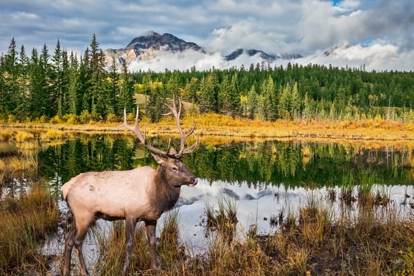
The Canadian Prairies
This region has many natural landscapes, forests, meadows and wheat fields stretch as far as the eye can see. In Drumheller, you will have the opportunity to visit the arid landscapes of the Canadian Badlands and its dinosaur fossils. Around Churchill, you might encounter a few bears amidst tundra wildflowers during fall or observe Beluga whales in the Hudson Bay.
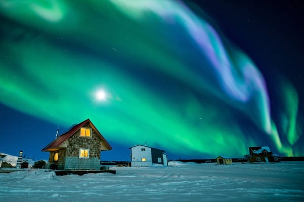
The North
With the Great Bear Lake, the Canol Heritage Trail, northern lights, the Great Slave Lake, dog sleds, midnight sun, the Klondike Gold Rush, panoramic roads, unspoilt nature and preserved fauna, the Yukon, Nunavut and Northwest territories are as good as their neighbouring regions.
Attractions maps
Among its many places of interest, the country has over 40 national and provincial parks. It is impossible not to find what you are looking for in this diversity of landscapes. With the Rockies and its two gigantic national parks, Banff and Jasper, western Canada, and more precisely British Columbia, have nothing left to prove. The Canadian prairies covering the central part of the country are just as beautiful and its Icefields Parkway won’t fail to impress you. The Quebec region is also a treasure trove of landscapes and cultural heritage with the Notre-Dame Basilica of Montreal, Saint Joseph's Oratory of Mount Royal, Plateau Mont-Royal and the Olympic Park. There are many other wonders to discover such as Toronto's famous CN Tower, the famous Niagara Falls, Old Quebec and the Plains of Abraham and the Montmorency Falls, which are just as breathtaking as the Niagara Falls. Not to mention the Jacques-Cartier National Park, the Ice Hotel and the Quebec Winter Carnival. In addition to that, the Maritime provinces known for their iceberg sightings in Newfoundland and Labrador, the Cape Breton Highlands National Park and its charming islands ensures that you won’t have time to get bored!
Routes and distances maps
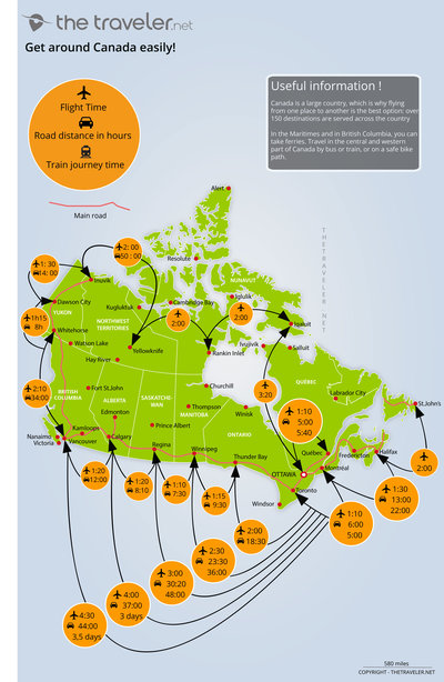
Unsurprisingly, flying from one city to another is the best way to travel long distances in Canada. Expect at least a one-hour flight between each major airport, and 5 hours to fly across the country. Air Canada flies to 64 Canadian cities. Cars, trains and buses are also very popular for discovering the countryside while saving money. Bicycle touring is also very popular and is an excellent way to visit Edmonton, Montreal, Quebec City, Ottawa, Toronto and Vancouver. In Montreal, buy a metro or bus ticket and the city will be yours! A 3-day pass will give you unlimited access to public transportation for about 19$. Vancouver’s public transportation is also very convenient, although the city-centre can be visited on foot. Ferries and sea buses will allow you to explore the surrounding islands. As for the centre and far north of the country, please refer to our map for an overview of these regions. Then, compare flight, train, bus and boat offers to find the best itinerary
You may also like
-
Flights to Canada
All you need to know before buying your plane ticket
-
Places to visit in Canada
The must-see attractions and the best places to visit Canada!
-
Hotel or vacation rental?
Find your dream accommodation in Canada at the best price...
-
When to go?
Be sure to visit Canada at the best time of year!
and why not...
 Norway

